October 2013
A contemporary bush fire event: October 2013 fires
It was one of the most significant fire emergencies NSW has experienced for many years.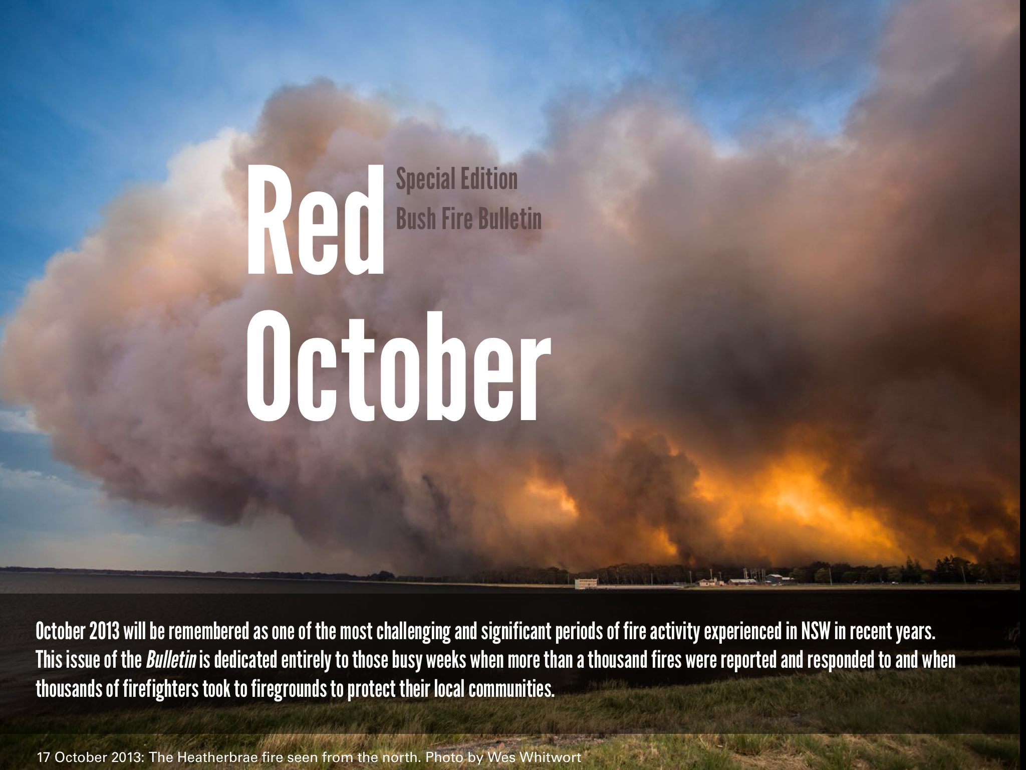
In the four weeks of October 2013 NSW RFS firefighters attended 1,167 bush and grass fires across NSW. This included significant fires in the Southern Highlands, Hawkesbury, Hunter, Port Stephens, Central Coast, Greater Lithgow and the Blue Mountains. In the Blue Mountains region, a number of large and destructive fires impacted on communities including Springwood and Winmalee, Mount Victoria, and communities along the Bells Line of Road, destroying homes and affecting infrastructure.
The afternoon of 17 October proved to be one the most destructive few hours of the past decade. More than 200 houses were destroyed across the Blue Mountains.
The October 2013 fires took a massive toll in terms of property, infrastructure and indeed on the firefighters themselves. The following magazines, stories, articles and photographs trace the response to the bush fire emergency from the point of view of the NSW RFS.
 |
 |
 |
| October 2013. A tribute |
Timeline of key fire events|
Red October: Summary of events |
|
| the Bush Fire Bulletin is the official journal of the NSW RFS and has been in publication for more than 60 years. This issue of the Bush Fire Bulletin is dedicated entirely to those busy weeks in October 2013 when more than a thousand fires were reported and responded to and when thousands of firefighters took to firegrounds to protect their local communities. Download the Bush Fire Bulletin as a PDF (150 pages). Or view all the recent copies of the Bush Fire Bulletin. | A graphic illustration of the fire events that occurred in NSW throughout October 2013 including the total of fires burning across NSW on each day of the month. | “About as bad as it gets” – that’s how the recent fire threat in October 2013 was described by NSW RFS Commissioner Shane Fitzsimmons. After the warmest winter on record, and without any substantial rain for many months, October 2013 saw conditions deteriorate further and a number of significant fires start. Watch a short video that summarises the events of October 2013. |
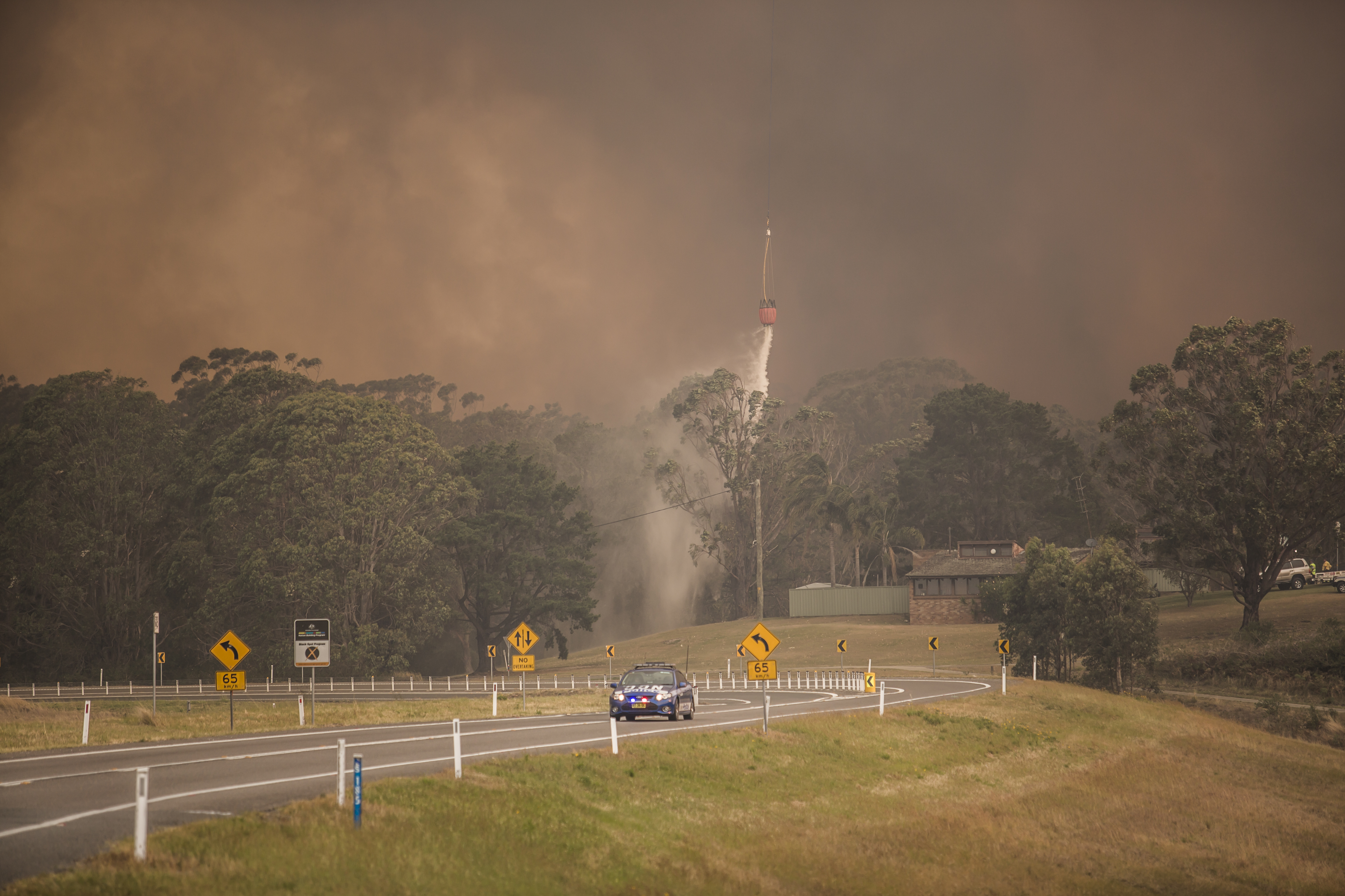
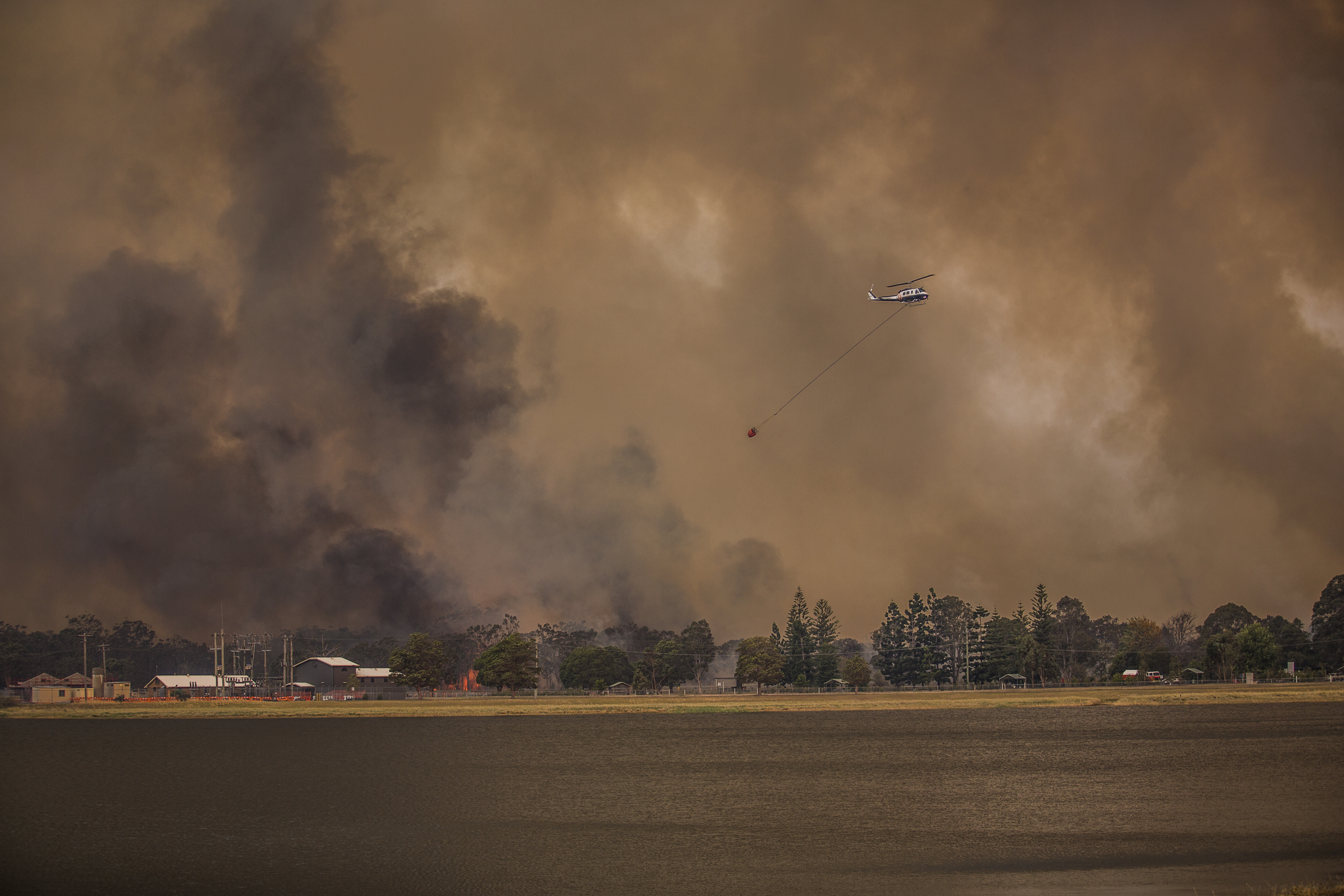
Fire behaviour at the Heatherbrae fire near Port Stephens, October 2013
The Heatherbrae fire, near Port Stephens, picked up speed and ferocity on Thursday 17 October 2013. Local 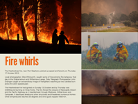 photographer Wes Whitworth caught some of the extreme fire behaviour in the Grahamstown and Williamtown areas.
The Heatherbrae fire had started on Sunday 13 October and by Thursday was 3,500ha and burning on three fronts. The fire forced the closer of Newcastle Airport and the Pacific Highway as it travelled east through Medowie, Williamtown and Campvale. It destroyed sheds and other structures and threatened numerous homes while temperatures reached 35 degrees and wind gusts topped 100kph. Along with West Whitworth's images is one photo from Daily Telegraph photographer, John Grainger, who caught an extraordinary image of local firefighters watching as two tree candles burn and a fire whirl speeds past.


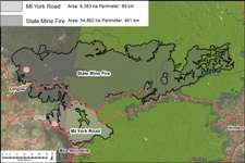
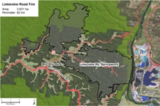
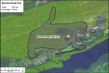
Maps showing burnt areas in the key fires of October 2013
How to understand the symbols on maps
Mapping Symbology for Fire Incidents explains what the symbols of fire maps mean. This two-sided poster can be printed out as a A3 poster.
Click below to see detailed maps of the burnt areas for the major fires in NSW during October 2013.
 |
 |
 |
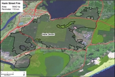 | 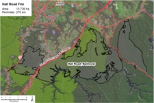 |
| Blue Mountains (State Mine and Mount York Fires) | Winmalee, Blue Mountains (Linksview Road) | Salt Ash Fire (Brownes Road) | Heatherbrae Fire (Hanks St) | Southern Highlands Fire (Hall Road) |

