Page breadcrumbs:
Goobang National Park Hazard Reductions
Published Date: 04 Apr 2013

Summary
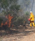
National Parks crews, with some assistance from local RFS have spent the past week conducting fuel reduction burning within the northern section of the Goobang National Park.
Claggers Hazard Reduction Burn
ALERT LEVEL: Not Applicable
LOCATION: Northern Goobang National Park
COUNCIL AREA: Cabonne
STATUS: Under Control
TYPE: Hazard Reduction
FIRE: Yes
SIZE: 391 ha
RESPONSIBLE AGENCY: NSW National Parks & Wildlife Service
Fabe Kerin South
ALERT LEVEL: Not Applicable
LOCATION: 10kms se of Tomingley
COUNCIL AREA: Cabonne
STATUS: Under Control
TYPE: Hazard Reduction
FIRE: Yes
SIZE: 960 ha
RESPONSIBLE AGENCY: NSW National Parks & Wildlife Service
In the Canobolas Zone area there have been 2 separate burns, along the Fabe Kerin Trail and the Claggers Springs Trail with the treated area totalling some 1200ha.
The area involved hasn't been burnt since the high intensity wildfire back in 2000. Fire trail work has been extensive since that time and crews used favourable weather conditions with aerial incendiary assistance to complete the burns.
Whilst burning is wrapping up today there will be smoke issuing from the area for the next few days as heavier fuels burn within the containment lines.


