Share this link

Plan and prepare

Farm Firewise

Farm FireWise helps NSW rural landholders prepare for and prevent bush fires. Farm FireWise helps you plan ahead to protect yourself, your family and your property from the potential impact of bush and grass fires.

Grass Fires

Grass fires spread quickly and can threaten lives, property, crops and stock. Protect yourself.

Prepare Your Animals for Bush Fire

During bush fires, people put themselves and others at risk attempting to rescue animals at the last minute. Some refuse to evacuate or go to a safe place because of concern about their animals.

Neighbourhood Safer Places

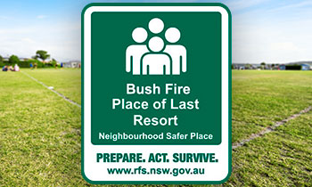
Neighbourhood Safer Places are a place of last resort during a bush fireNeighbourhood Safer Places are a place of last resort during a bush fire emergency.

They are to be used when all other options in your bush fire survival plan can't be put into action safely.

You should be aware of any Neighbourhood Safer Places in your area, and note them in your bush fire survival plan before a bush fire occurs. You should also know how to get there, as well as alternate routes in case the road is blocked or too dangerous to drive on.

Not all areas will have a Neighbourhood Safer Place. If there is no Neighbourhood Safer Place in your area, you should identify other safer locations you can go to as a last resort. This might include a nearby home which is well prepared, a shopping centre or oval which is well away from the bush.

A Neighbourhood Safer Place is designed as a Place of Last Resort in bush fire emergencies only. Please note that travelling to or sheltering at a Neighbourhood Safer Place does not guarantee your safety.

Wingecarribee Local Government Area

Title Type Location LGA
Hill Top RFS Station Building West Parade, Hill Top Wingecarribee
Colo Vale Community Hall Building 28 Railway Avenue, Colo Vale Wingecarribee
Yerrinbool RFS Station Building Everest Street, Yerrinbool Wingecarribee
Bunnings Car Park Open Space Tyree Place, Braemar Wingecarribee
Gantry Place, Willow Vale Open Space Gantry Place, Willow Vale Wingecarribee
Winifred Reserve Open Space Regent Street, Mittagong Wingecarribee
Welby Hall Building Currockbilly Street, Welby Wingecarribee
Berrima Reserve Open Space Corner of Old Hume Highway and Market Place, Berrima Wingecarribee
Casburn Park Open Space Railway Parade, Wingello Wingecarribee
Bowral CBD Open Space Bong Bong Road, Bowral Wingecarribee
Penrose Rural Fire Station Building Crn Kareela Road & Penrose Forest Road, Penrose Wingecarribee
Loseby Park Open Space Corner of Sheffield Road and Park Road, Bowral Wingecarribee
Bundanoon Oval Open Space Erith Street, Bundanoon Wingecarribee
Exeter Oval Open Space Exeter Road, Exeter Wingecarribee
Lackey Oval Open Space Lackey Road, Moss Vale Wingecarribee
Robertson Community Centre Open Space Caalong Street, Robertson Wingecarribee
Coles Express Suttons Forest Service Stations (North and South) Open Space Hume Highway, Suttons Forest Wingecarribee
Balmoral Rural Fire Station Building Railway Parade, Balmoral Wingecarribee

Wollondilly Local Government Area

Title Type Location LGA
Land adjacent to Bargo Hotel Open Space 225-227 Great Southern Road, Bargo Wollondilly
Wollondilly Youth Hub/ Community Centre Building Harper Close, Tahmoor Wollondilly
Picton High School Building 480 Argyle Street, Picton Wollondilly
Cawdor Public School Building 685 Cawdor Road, Cawdor Wollondilly
The Oaks Public School Building John Street, The Oaks Wollondilly
The Oaks Hall Building Russell Street, The Oaks Wollondilly
Tahmoor Town Centre Carpark Open Space Cnr of Thirlmere Way and Remembrance Drive, Tahmoor Wollondilly
St Mary's Towers Open Space 415 Douglas Park Drive, Douglas Park Wollondilly
Thirlmere Public School Open Space Oaks Street, Thirlmere Wollondilly
Wilton Community Centre Building Broughton Street, Wilton Wollondilly
Picton Bowling Club Building 55-56 Argyle Street, Picton Wollondilly
Oakdale Shops Building Burragorang Road, Oakdale Wollondilly
Oakdale Community Hall Building Cnr Egans Road and Burragorang Road, Oakdale Wollondilly
Bargo Shops Open Space Remembrance Drive, Bargo Wollondilly
Thirlmere Memorial Park Open Space Oaks Street, Thirlmere Wollondilly
Main Street Appin Open Space Appin Road, Appin Wollondilly
Carpark between Coles & Council Admin Building Open Space Margaret Street, Picton Wollondilly
Buxton Fire Shed Building West Parade, Buxton Wollondilly
Hall within Bargo Showground Building Radnor Road, Bargo Wollondilly
Warragamba Public School Hall Building Weir Road, Warragamba Wollondilly
Mt Hunter Community Hall Building Corner of Burragorang Rd and Clyde Place, Mt Hunter Wollondilly