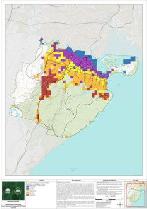
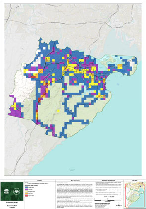
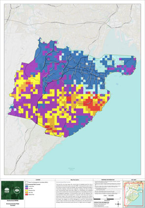
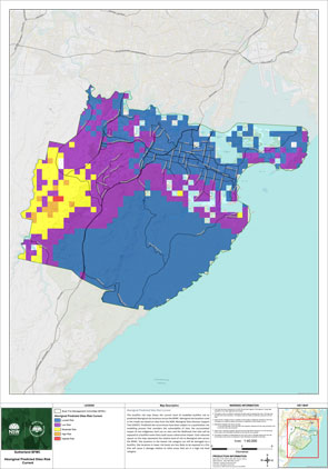
Bush fire risk in Sutherland
Fire agencies, land managers and other stakeholders have been working to identify ways of reducing the impact of fires on our area – protecting lives, homes, businesses, agriculture, the environment and other assets that are important to Sutherland.
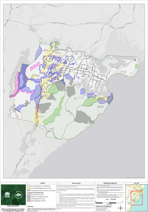
The local Bush Fire Management Committee has developed a Bush Fire Risk Management Plan, which identifies the risks and the plans to protect them.
The plan identifies the risk to communities and the assets we all value. Using feedback from fire agencies, land managers and other stakeholders, the plan identifies ways of reducing the impact of fires across our area.
By planning together, we will help shape the Bush Fire Risk Management Plan for our area for the next five years.
How the Sutherland Bush Fire Risk Management Committee have assessed the risk
Fire is a part of living in NSW. It has been a part of this landscape for millions of years.
As our population and region changes, the risk of fires impacting on our community has changed.
To understand the bush fire risk in Sutherland, and help inform the best ways of managing and reducing the risk, we’ve looked at what’s important to local communities – including where people live, as well as environmental, economic and cultural assets.
We look at the assets across the landscape, and using computer modelling, we have tested scenarios for possible fire conditions to understand the impact on the community.
Managing the risk in Sutherland
We have considered the risk to people and assets across the area to determine the most appropriate and effective way of managing that risk.
There are some measures which apply broadly – such as vegetation management, development controls, bush fire education, and fire suppression activities. These activities reduce the bush fire risk to assets and communities throughout the area.
Where an unacceptable risk exists for a particular area or assets, additional targeted treatment strategies are planned during the next five-year period. These treatment options include:
- Fuel management – the reduction or modification of bush fire fuel with the intent of slowing the spread of bush fire and aiding firefighting operations. This may be identified as;
- Asset protection zones – these are typically close to homes, and provide a separation from the bushland to reduce the impact of fires, and give firefighters a safe place to work if protecting homes in a fire;
- Ignition management zones – areas in the landscape maintained at a reduced fuel level to minimise the propagation of ignitions and limit the rapid escalation of fires;
- Strategic fire advantage zones – these are areas across the broad landscape which, when treated, can help slow the spread of a fire across the landscape;
- Firebreaks – areas designed and managed to provide fuel reduced areas from which a fire can be suppressed.
- Ignition prevention – activities to prevent or reduce bush fire ignitions whether they be accidental or deliberate. This includes community preparedness programs, fuel management and specific actions in the Ignition Prevention Plan.
- Community preparedness – activities such as working with residents to improve their level of planning and preparation for a fire, to increase the survivability of their home and families in the event of a fire.
- Response – specific response requirements for a particular area or value in addition to standard procedures. This may include specific actions in the BFMC Plan of Operations or Fire Access and Fire Trail plan.
Sutherland Bush Fire Management Committee is made up of a range of stakeholders from the area including emergency services, land management agencies, local government and local Aboriginal land services, and local community groups. This ensures key community stakeholders have a say on bush fire management activities for the benefit of their communities.
Sutherland Bush Fire Management Committee is made up of the following representatives:
- NSW Rural Fire Service
- Sutherland Shire Council
- Fire and Rescue NSW
- NSW Police
- Ausgrid
- Local Land Services
- NSW National Parks and Wildlife Service
- NSW Department of Planning and Environment (Crown Lands)
- Nature Conservation Council of NSW
- Local Aboriginal Land Councils
- Transport for NSW (including Sydney Trains)
- ANSTO
- Department of Defence
- Sydney Water
- WaterNSW
- Ampol (observer)
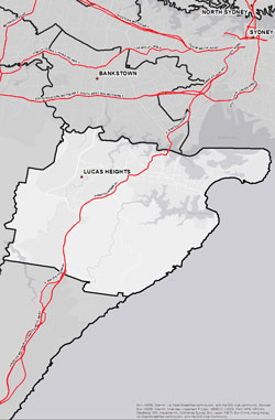
The Sutherland Bush Fire Management Committee area spans 368,800 hectares (ha). The area covers the Local Government Area (LGA) of Sutherland and features National Parks covering an area of 17,438ha (4.2% of BFMC Area).
The Sutherland area has approximately 69.2% bushland and 4.9% grassland with the balance being the built environment or water bodies. A bush or grass fire can happen at any time of the year, but the risk is higher during the warmer months, when bush, grass or scrub is drier.
-
 According to the Australian Bureau of Statistics 2021 Census Community Profile there are 88,446 residential dwellings in the Sutherland BFMC area with an approximate population of 224,192.
 -
 According to the ABS data on the counts of Australian businesses, there were 11,467 businesses in the Sutherland BFMC. The top three industries include Rental, Hiring and Real Estate Services, Construction and Professional, Scientific and Technical Services. These account for 54% of businesses in the Sutherland BFMC.
 -
 Significant bush fire events occurred in the 2017/18 and 2020/21 bush fire seasons with 4,323 and 593 hectares burned respectively.
 -
 There are several valuable community assets across the area along with a number of culturally significant sites and environmentally important sites.


