Plan and prepare
Farm Firewise
Farm FireWise helps NSW rural landholders prepare for and prevent bush fires. Farm FireWise helps you plan ahead to protect yourself, your family and your property from the potential impact of bush and grass fires.
- Introduction to Farm FireWise (PDF, 3.3 MB)
- Guide to Farm FireWise (PDF, 13.8 MB)
Grass Fires
Grass fires spread quickly and can threaten lives, property, crops and stock. Protect yourself.
- Grass Fires Factsheet (PDF, 753.3 KB)
Prepare Your Animals for Bush Fire
During bush fires, people put themselves and others at risk attempting to rescue animals at the last minute. Some refuse to evacuate or go to a safe place because of concern about their animals.
- Livestock and Large Animals (PDF, 938.2 KB)
- Fire Safety for Your Pets (PDF, 783.9 KB)
Neighbourhood Safer Places
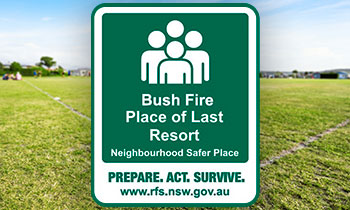 Neighbourhood Safer Places are a place of last resort during a bush fire emergency.
They are to be used when all other options in your bush fire survival plan can't be put into action safely.
You should be aware of any Neighbourhood Safer Places in your area, and note them in your bush fire survival plan before a bush fire occurs. You should also know how to get there, as well as alternate routes in case the road is blocked or too dangerous to drive on.
Not all areas will have a Neighbourhood Safer Place. If there is no Neighbourhood Safer Place in your area, you should identify other safer locations you can go to as a last resort. This might include a nearby home which is well prepared, a shopping centre or oval which is well away from the bush.
A Neighbourhood Safer Place is designed as a Place of Last Resort in bush fire emergencies only. Please note that travelling to or sheltering at a Neighbourhood Safer Place does not guarantee your safety.
You can find your closest Neighbourhood Safer Place on our interactive map.

