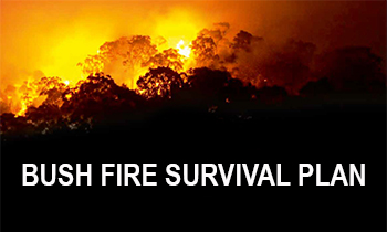
Why we need a plan
Bush Fire Risk Management Plans are an effective instrument for managing risk to human activity and valued community and environmental assets. They are a key component in a multifaceted bush fire management approach for NSW.
Developed using robust data and sophisticated technology and modelling, the plans determine risk factors and develop solutions that best mitigate them.
Feedback from the exhibition of a draft plan for Cudgegong is currently being assessed. Public feedback will be taken into consideration as the plan is finalised by the Cudgegong Bush Fire Management Committee before being sent to the Bush Fire Coordinating Committee for review.
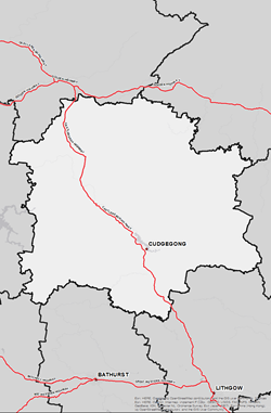
Current Bush Fire Risk Management Plan for Cudgegong
The current Bush Fire Risk Management Plan for the Cudgegong (Mid-Western) area was published on 13 October 2020.
This plan identifies the bush fire risks in each location and sets out the types of work scheduled to deal with the risk of bush fires.
Bush Fire Risk Management Plans are updated within every five-year period, however, the treatments and works set out in the plans are subject to change on a yearly basis due to fire activity, weather and new risk factors. This plan may not have been updated with the latest treatment and works plans/information.
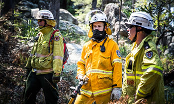
The Cudgegong BFMC is made up of a range of stakeholders from the area including emergency services, land management agencies, local government, local Aboriginal land services and local community groups. This ensures key community stakeholders have a say on bush fire management activities for the benefit of their communities.
Cudgegong BFMC is made up of the following representatives:
- NSW Rural Fire Service
- NSW National Parks and Wildlife Service
- Forestry Corporation of NSW
- Fire and Rescue NSW
- NSW Department of Planning, Housing and Infrastructure (Crown Lands)
- Mid-Western Regional Council
- Central Tablelands Local Land Services
- NSW Department of Primary Industries
- Nature Conservation Council of NSW
- Mudgee Local Aboriginal Lands Council
- Mid-Western Local Emergency Management Officer (LEMO)
- Mid-Western Local Emergency Operations Controller (LEOCON)
- NSW Police Force
- NSW Farmers’ Association
- Transgrid
- Endeavour Energy
- Essential Energy
- Transport for NSW
- UGL Regional Linx
- Water NSW
- Glencore (Ulan Coal)
- Peabody (Wilpinjong Mine)
- Yancoal (Moolarben Coal)
The Cudgegong BFMC area spans 873,687 hectares (ha). The area covers the Local Government Area (LGA) of Mid-Western Regional and features National Parks covering an area of 101,005ha (11.56% of BFMC area) and State Forests covering an area of 16,796ha (1.92% of BFMC area).
The Mid-Western Regional Council area is made up of approximately 59% bushland and 39% grassland with the balance being the built environment or water bodies. A bush or grass fire can happen at any time of the year, but the risk is higher during the warmer months, when bush, grass or scrub is drier.
-
 According to the Australian Bureau of Statistics 2021 Census Community Profile there are 11,339 residential dwellings in the Cudgegong BFMC area with an approximate population of 23,557 across four main population centres (Mudgee, Gulgong, Kandos, Rylstone) and a number of smaller villages and rural residential estates.
 -
 According to the ABS data on the counts of Australian businesses, there were 2,690 businesses in the Cudgegong BFMC. The top three included agriculture, fisheries and forestry; construction; and professional, scientific and technical services, accounting for approximately 57% of businesses in the Cudgegong BFMC.
 -
 The last major bush fire happened during the 2022/23 bush fire season with 17,977 hectares burnt.
 -
 There are several valuable community assets across the area along with a number of culturally significant sites and environmentally important sties.

For more information contact your local NSW RFS Fire Control Centre

